
These are available from any customer specified locations for most of the world, price (excluding p&p/admin) per viewpoint:
Sample Downloads:
The view from Mount Whitney may be saved to disk, then recalled and compared with the following photographs (7 August 2003, copyright John Samson):- Charleston Peak 093-103, 146 miles; San Gorgonio Mountain 148-153, 190 miles; San Antonio, Baden Powell 164-174, 162 miles; Mount Pinos 197-205, 131 miles
The panoramas listed below are all included on a single CD, price £5.
Individual encapsulated copies of the viewpoints listed below in CAPITALS are double sided 11" x 8" with four 11" x 2" 45 degree strips on each side. Price £3.00 each. The rest are double sides 11" x 4" with four 11" x 1" 45 degree strips on each side. Price £2.00 each.
USA DENALI (Alaska), Mt WHITNEY (California), PIKE'S PEAK (Colorado), Mt WASHINGTON (N.H.), CHARLESTON PEAK (Nevada), Mt DIABLO (California) plus more to come
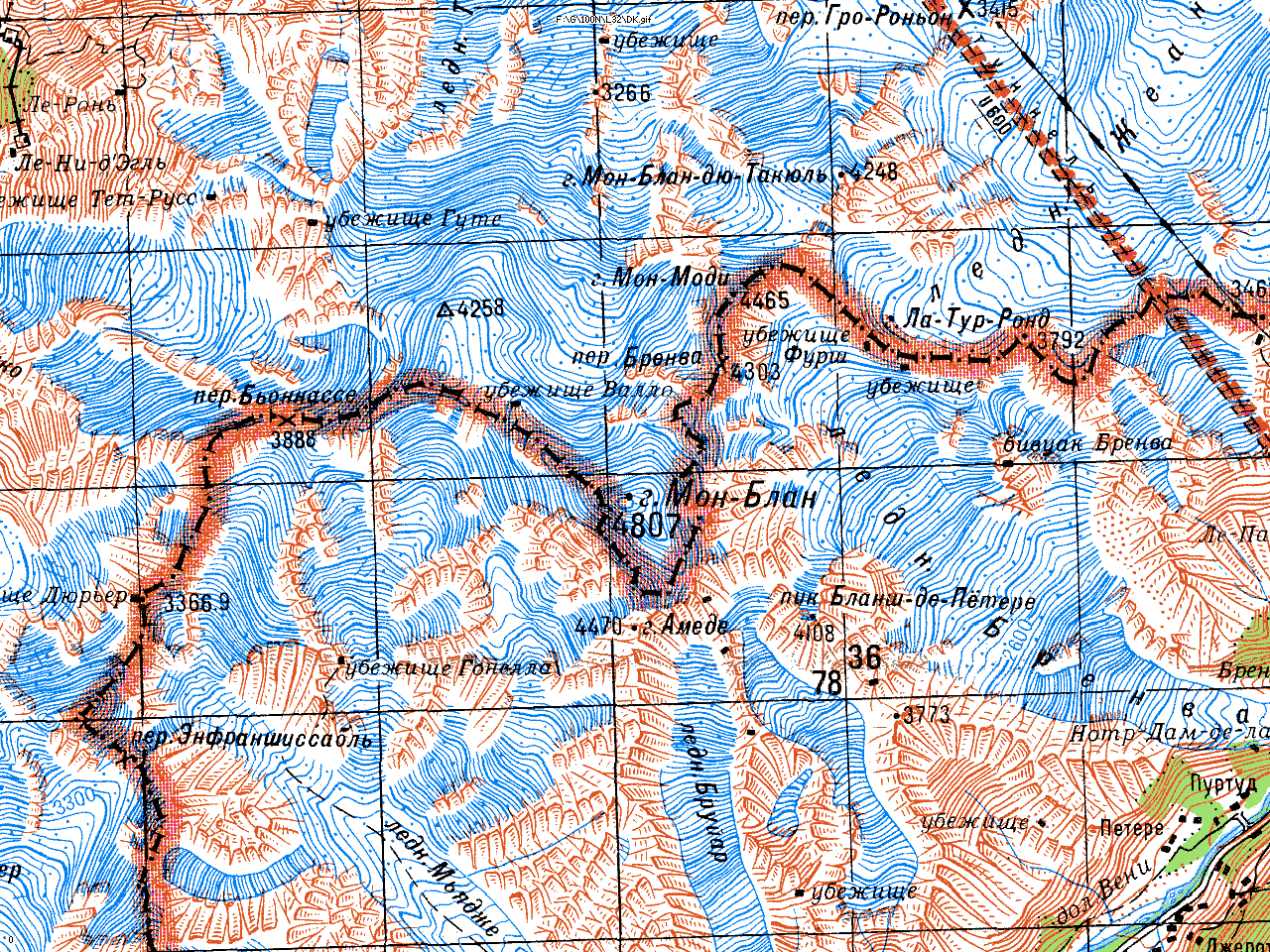
EUROPE MONTE ROSA DUFOURSPITZE (Switzerland/Italy), MARMOLADA (Italian Dolomites), TRIGLAV (Slovenia), FINSTERAARHORN (Swiss Alps), PIZ LANGUARD (Swiss Alps), ZUGSPITZE (Germany/Austria), BREITHORN (Zermatt, Switzerland), GALDHOPIGGEN (Norway) plus more to come
SCOTLAND NORTHWEST HIGHLANDS BEN WYVIS, SUILVEN, Beinn Alligin (Torridon), Sgurr Fhuaran (Kintail), Carn Eige, Ladhar Bheinn, Ben Hope, Ben Klibreck, An Teallach, Morven (Caithness), Beinn Alligin Bheinn (Moidart), Sgurr na Ciche, Beinn Resipol, Ben Hiant (Ardnamurchan).
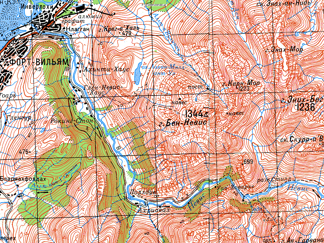
GRAMPIANS BEN NEVIS, BIDEAN NAM BIAN, BEN LAWERS, BEN LOMOND, CAIRN GORM, BEN VORLICH (Loch Earn), SCHIEHALLION, Ben Macdui, Beinn Ime, The Cobbler, Ben Ledi, Ben Chonzie, Ben Lui, Ben More (Crianlarich), Ben Alder, Ben Cruachan, Ben Vrackie, Glas Maol, Driesh, Lochnagar, Ben Rinnes.
ISLANDS BEN MORE (Mull), ASKIVAL (Rum), GOATFELL (Arran), CLISHAM (Harris), Beinn Talaidh (Mull), Beinn Charsaig (Mull), Dun Da Ghaoithe (Mull), Meall an Inbhire (Mull), Suainaval (Lewis), Sgurr Alasdair (Skye), Hecia (South Uist), Heaval (Barra), Ben Hynish (Tiree), Beinn an Oir (Jura), Beinn Bheigier (Islay), Beinn Tart a'Mhill (Islay).
CENTRAL WEST LOMOND (Fife), BEN CLEUCH (Ochils), Hill of Stake (Renfrew), Beinn an Tuirc (Kintyre), Duncryne Law (Drymen), Earl's Seat (Campsies), East Lomond (Fife), Largo Law (Fife), Norman's Law (Fife), Arthur's Seat (Edinburgh), Edinburgh Castle, Lyne Hill (Greenock), Cleish Hills (Fife), Knock Hill (Fife), Benarty Hill (Fife), Kinnoull Hill (Perth), Dundee Law.
UPLANDS MERRICK, Cairnsmore of Fleet, Cairnsmore of Carsphairn, Beneraird (South Ayrshire), Criffel (Dumfries), Tinto, Culter Fell, Dun Rig, Lowther Hill, Queensberry, Broad Law, Scald Law (Pentlands), Lammer Law, Middle Eildon Hill.
ENGLAND CUMBRIA SCAFELL PIKE, OLD MAN OF CONISTON, SKIDDAW, GREAT GABLE, HELVELLYN, Grasmoor, High Street, Harter Fell, (Hardknott), Black Combe, Binsey.
OTHER ENGLAND The Cheviot, Cross Fell, Whernside, Pen-y-Ghent, Ingleborough, Wards Stone (Bowland), Winter Hill (Bolton), Kinder Scout (Peak), Shining Tor (Buxton), The Roaches (Buxton), The Wrekin (Telford), Brown Clee Hill, Titterstone Clee Hill, Malvern Hill, Dartmoor (High Willhays).
ISLE OF MAN SNAEFELL.
WALES SNOWDON, CADAIR IDRIS, GLYDER FAWR, CARNEDD LLEWELYN, MOEL HEBOG, PEN-Y-FAN (Brecon), Cadair Berwyn, Moel Famau, Plynlimon, Foel Cwmcerwyn (Prescelly), Waun Fach (Black Mountains).
IRELAND LUGNAQUILLIA (Wicklow), GREAT SUGAR LOAF (Wicklow), CARRAUNTOOHIL (Kerry), SLIEVE DONARD (Mourne), GREAT SUGAR LOAF (Wicklow), CARRAUNTOOHIL (Kerry), SLIEVE DONARD (Mourne), Knocklayd (Antrim), Cuilcagh (Fermanagh), Slieve Snaght (N.E. Donegal), Errigal (Donegal), Croagh Patrick (Mayo), Mwellrea (Connemara), Mount Leinster, Galtymore, Mangerton (Kerry), Brandon (Kerry).
This can be supplied for much of the world. Prices for non-commercial use are based on media and reproduction costs, currently set at £5 per CD(670MB), £10 per DVD(4GB), plus p&p and adminstration. As a guide, the 1:200,000 sets run to a total of about about 40GB.
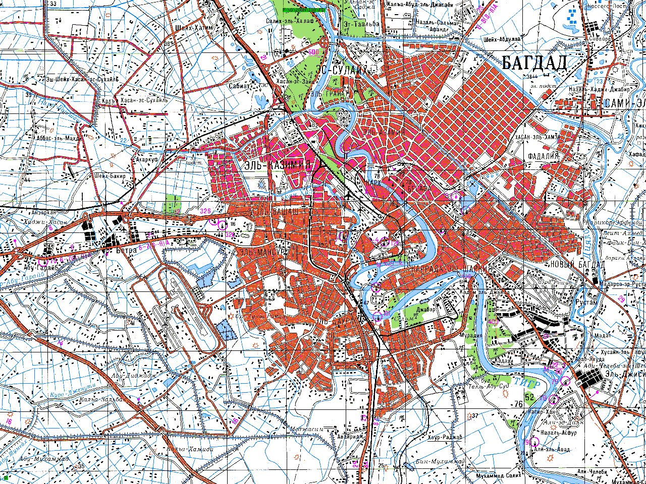
Digital Raster Mapping:
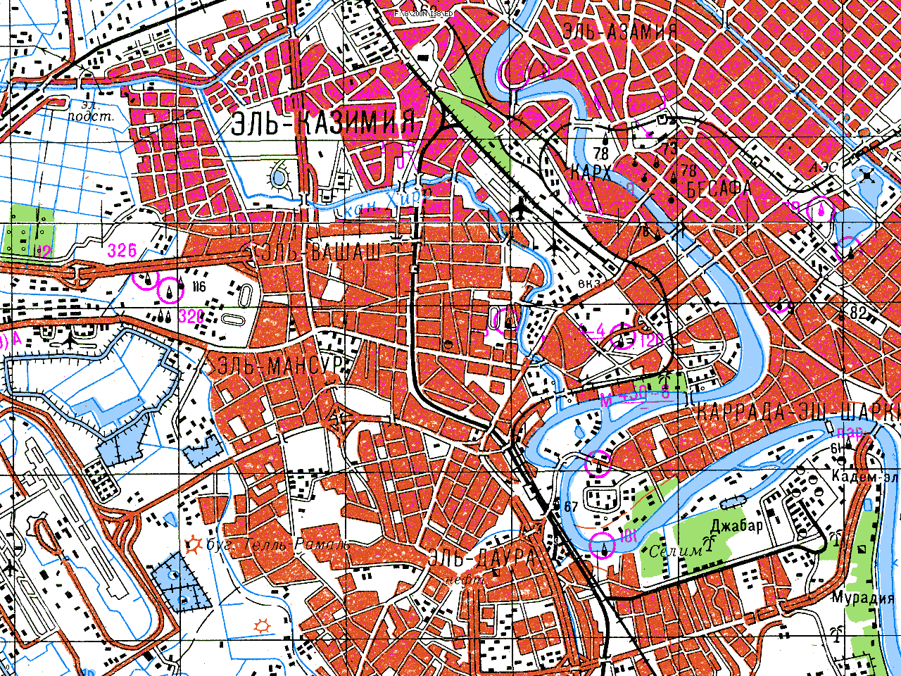
The above sets are available in indivisible 6 x 4 degree blocks. The file sizes, which are small enough to allow legible A4 printing, vary; for the 1:200,000 set it is 30'x20', i.e. 12x12=144 files per block. Other than the USA, the sets are based on Soviet military mapping and are in Russian. A guide to the Russian alphabet is supplied. Software to enable smooth scrolling between files, including across UTM boundaries, and interact with the DEMs (see below), is also available.
Sample downloads:
Other sets, including the USA at
1:24,000 and 1:100,000, Canada/Australia at 1:250,000 may be available to non-commercial users on a limited basis but these sets are subject to copyright
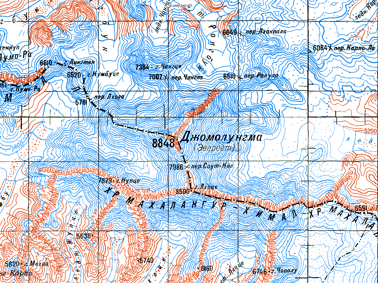
restrictions. Digital Elevation Models: These are matrices of 16-bit elevations, in metres relative to sea level. The following sets are available: DEM Downloads . Download 1°x1° tiles in SRTM format. Contain 1201x1201 16-bit elevation cells, resolution 3". Similar to SRTM but with no-data areas filled from other sources. Gazetteers:
Global, detail compatible with 1:250,000 or
better, but in some areas accuracy is no better than about 1km. Available in 6x4
degree blocks. Based on USGS GNIS. Global file size approx 900MB.
A complete gazetteer of over 20,000 summits in the Alps, including accurate coordinates and elevations, can be downloaded here. Documentation for the fields used in this file can be downloaded here.
Special gazetteers, ranking mountain summits in
order of prominence, i.e. drop separating them from higher summits, can be downloaded here.